
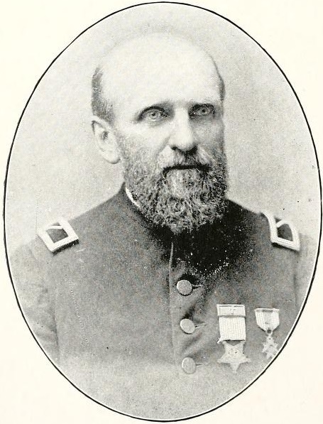
At a glance: Scottsdale begins with water. The Hohokam taught this valley to drink a thousand years before statehood; the Arizona Canal of 1885 reopened the tap; and in 1888 a 51-year-old Army chaplain named Winfield Scott bet $2.50 an acre that a square mile of creosote flats would grow oranges. He was right about the land and wrong about the oranges — and that tension between big promises and stubborn desert defines every decade that follows.
The valley the Hohokam built first
Nothing about Scottsdale’s founding makes sense without the people who came first. From roughly 450 to 1450 CE, the Hohokam built the largest irrigation system in the ancient Americas north of Peru — hundreds of miles of hand-dug canals pulling Salt River water onto fields of corn, beans, squash, agave, and cotton. Some main channels were wider than a two-lane road. Their engineering was so precisely graded that when Anglo settlers arrived in the 1860s, they found they could simply clean out the old alignments and run water through them again.
Around 1450 the Hohokam vanish from the archaeological record — drought, floods, and social collapse are the leading theories — but their descendants never left the valley. The Akimel O’odham (Pima) and Piipaash (Maricopa) peoples continued farming along the rivers, and in 1879 the federal government established the Salt River Reservation — today’s Salt River Pima-Maricopa Indian Community — along what would become Scottsdale’s entire eastern border. That boundary, drawn nine years before Winfield Scott showed up, still shapes the city’s map today.
1883–1885: the Arizona Canal changes everything
Phoenix already existed by the 1880s, built on re-excavated Hohokam ditches south of the future Scottsdale. What didn’t exist was any way to water the higher desert bench to the northeast. That changed when the Arizona Canal Company hired railroad contractor William J. Murphy to dig a 42-mile canal from a diversion dam on the Salt River clear around the north side of the valley.
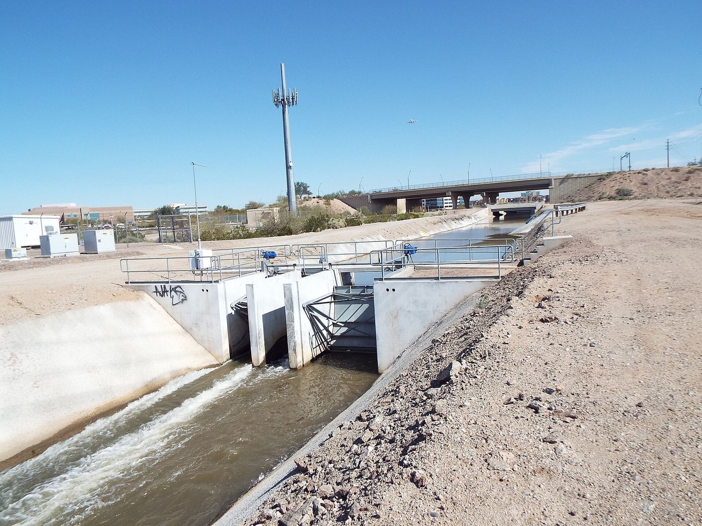
Murphy’s crews finished the Arizona Canal in 1885. It was the first Valley canal that ignored the ancient alignments entirely, cutting through virgin desert at a higher elevation — which meant a whole new tier of land could suddenly be farmed, including a certain empty square mile that had nothing on it but creosote, mesquite, and jackrabbits.
Land under the new canal sold cheap, and promoters fanned out across the country to find buyers. One of the people they found was an Army chaplain with a famous name.
1888: the chaplain files his claim
Winfield Scott — named for the War of 1812 general, no relation — was born in Michigan in 1837, left a Syracuse Baptist pulpit in 1862 to raise a company of the 126th New York — he was wounded at Harpers Ferry, twice at Gettysburg and twice at Spotsylvania — and after the war returned to the ministry, becoming a U.S. Army chaplain in 1882. Postings took him west; promotional literature about the Salt River Valley took him the rest of the way.
In 1888, Scott visited the valley, liked what he saw, and filed on 640 acres — a full section — bounded by today’s Scottsdale Road, Hayden Road, Indian School Road, and Chaparral Road. The price was $2.50 an acre, with 50 cents an acre down: $320 to stake a claim on what is now some of the most valuable real estate in Arizona. He later gave back the 40 acres north of the canal, which it could not water, and paid $1,520 in all for 600 acres; The Ledger follows the money.
Scott was still an active-duty chaplain, so in 1889 he sent his brother George Washington Scott ahead to live on the claim, clear the brush, and get water flowing from the canal’s lateral ditches. George — a Civil War veteran himself — camped on the property and became the first permanent resident of what would become Scottsdale.
Barley, citrus, and the first hard lessons
The Scotts planted with an optimist’s portfolio: citrus, figs, almonds, grapes, peanuts, and barley. Winfield, an energetic promoter, believed the area could become a citrus colony to rival California — early on, the property was even associated with the hopeful name “Orangedale.”
The desert had opinions. Hard freezes in the early years killed much of the citrus, and the sandy bench soil drank irrigation water faster than anyone expected. Barley, alfalfa, and orchard crops that could take the heat did better. The lesson every Scottsdale farmer would relearn for the next half-century was already on the table in 1889: the land rewards you, but only on its own terms.
What the 1880s left behind was small but decisive — a canal, a claim, a first resident, and a founder who spent the rest of his life recruiting neighbors. The actual town, its name, its school, and its first store all belong to the 1890s, when a handful of families turned Scott’s section into a settlement.
Why the 1880s still matter in Scottsdale today
- The street grid remembers the claim. Scottsdale, Hayden, Indian School, and Chaparral Roads trace the boundaries of Scott’s original 640 acres; Old Town sits inside it.
- The Arizona Canal still runs. It crosses the city today carrying Salt and Verde River water, with the Arizona Canal Trail on its banks — you can ride the founding infrastructure.
- The eastern border predates the town. The Salt River Pima-Maricopa Indian Community’s 1879 boundary is why Scottsdale grew north instead of east, a fact that shaped everything from the 1960s annexation race to the McDowell Sonoran Preserve.