At a glance: Between the Hohokam and the chaplain lie four centuries that Scottsdale’s history usually skips. They shouldn’t be skipped. In them the McDowells became Yavapai country and the rivers O’odham country; three empires claimed the valley without ever walking into it; and then, between 1865 and 1887, the United States arrived with a fort, a county, a reservation, a railroad and a 42-mile canal. Every boundary on the modern Scottsdale map was drawn in those twenty-two years.
Two homelands
When the Hohokam villages emptied, the land did not. From about 1450 the Kwevkepaya, the southeastern Yavapai, treated the McDowells, Four Peaks, the Mazatzals and the Superstitions as one range: they sheltered in the same rock overhangs the Archaic hunters had used, roasted agave, and came down to Paradise Valley and the northern McDowells for yucca to weave into baskets. Six sites in today’s Preserve carry their wiped-plainware pottery; the Brown’s Ranch shelter, used for eight thousand years, was theirs last. Spanish and American writers, who could not tell them from Apaches, called them “Mohave-Apache,” and the confusion still lingers on old maps.
On the rivers lived the Akimel O’odham — “River People,” the Pima of the Spanish records — whom Father Kino met at Casa Grande in November 1694, and whom his own census counted at 1,118 in five Gila villages. In the 1820s and 1830s they were joined by the Piipaash (Maricopa), Yuman-speaking bands migrating up from the lower Colorado; the two peoples became one alliance, and at Pima Butte on September 1, 1857 they destroyed a Quechan-Mohave war party in what is often called the last major battle between Native nations in North America. The O’odham and the Yavapai were enemies, which is why O’odham families stayed off the mountains that are now the Preserve — and why the Spanish never got here.
Claimed, never occupied
Kino tried. “Repeated efforts by Father Kino to enter the Salt River Valley in the early 1700s were prevented by his Pima guides,” the Preserve’s cultural plan notes drily; he saw the Salt only where it joins the Gila. Sedelmayr passed that junction in 1744, Garcés wrote in 1770 that the Gila turned salty “because of the junction with the Rio Salado,” and Anza’s expeditions of 1774–76 marched down the Gila to Yuma without a detour. Spain, then Mexico, held the Salt River Valley on paper only. In 1829 Kit Carson trapped beaver up the Salt to the mouth of the Verde and found no one but Yavapai.
The valley passed to the United States with the Treaty of Guadalupe Hidalgo in 1848 — north of the Gila, so not by the Gadsden Purchase of 1853, whatever the roadside markers say. In 1852 the boundary surveyor John Bartlett published the first American account of the Hohokam ruins. New Mexico Territory gave way to Arizona Territory on February 24, 1863, and the Territory promptly went to war with the Yavapai.
The fort on the Verde
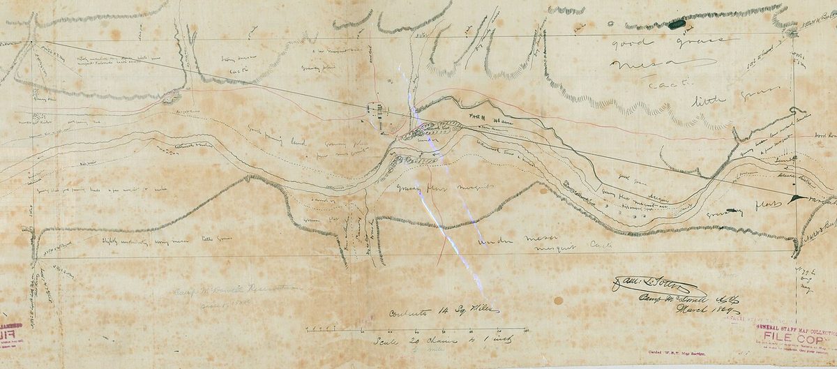
On September 7, 1865, 464 soldiers and seven officers who had marched from Maricopa Wells three days earlier “formed a permanent Camp called Camp McDowell” seven miles up the Verde from the Salt. Two of the companies were Pima and Maricopa volunteers; they cut the first wagon road into the country, and two of them were killed in an ambush on the road to the Salt River on New Year’s Day 1866. The post’s hay camp on the south bank of the Salt, run by John Y.T. Smith, was the first American settlement in the valley. In 1870 Colonel George Stoneman laid out a military road northwest from the fort, past Pinnacle Peak and Black Mountain toward Prescott. Its corridor crosses the north end of today’s Preserve, though a 2011 study found that the stretch long recorded as the road at Brown’s Ranch was E.O. Brown’s own ranch road.
The fort’s purpose was the Yavapai wars, and the war’s worst day came on December 28, 1872. Guided by a Tonto scout, Captain William Brown’s 5th Cavalry and about a hundred Pima scouts from Fort McDowell surrounded a Kwevkepaya band in a cave above the Salt River canyon, ricocheted rifle fire off the ceiling and rolled boulders from the rim. The Army counted 76 dead; the tribe says closer to a hundred. Among the survivors was an infant named Wassaja, who would be sold to a photographer, educated in Chicago as Dr. Carlos Montezuma, and return half a century later to fight for the reservation. The Yavapai surrendered at Camp Verde in April 1873, and on February 27, 1875 — “Exodus Day” — some 1,400 Yavapai and Tonto Apache were marched 180 miles over the winter mountains to San Carlos. Hundreds died. The survivors’ return to the Verde in the 1890s and the 1903 executive order creating the Fort McDowell reservation belong to a later chapter, but they explain the neighbor northeast of Scottsdale’s mountains.
Phoenix, the county, and a reservation nine years early
The valley’s first farmers under the American flag were the Phoenix pioneers of 1867–68, who cleaned out a Hohokam ditch under Jack Swilling and cut wheat by summer. Maricopa County was carved from Yavapai County on February 14, 1871; Charles Trumbull Hayden’s ferry gave Tempe its start the same year; Phoenix incorporated in 1881.
The O’odham and Piipaash arrived at the Salt the same decade, and not by choice. Settlers at Florence had begun diverting the Gila in 1866; by 1871 Chief Giaho Chiñkam told the agent he was taking his people to the Salt “as there was no water for his fields.” By 1878 more than a thousand were farming north of the river opposite Tempe, and that season they raised 300,000 pounds of wheat on 1,520 acres. When sixteen settlers tried to file homestead claims on those fields, Captain Adna Chaffee of Camp McDowell called it “nothing more nor less than a legal steal of about a thousand acres of improved land.” Washington overreacted, then corrected: President Hayes’s order of January 10, 1879 set aside roughly 680,000 acres along the Salt, swallowing Phoenix, 5,000 settlers and Camelback Mountain, and “set off an almighty howl.” The order of June 14, 1879 replaced it with the Salt River Reservation — 46,627 acres north of the river, south of Camp McDowell — and quietly dropped the government’s obligation to provide comparable water rights. That eastern line, today’s Salt River Pima-Maricopa Indian Community, was on the map nine years before Winfield Scott.
1883–1885: the canal that reached the bench
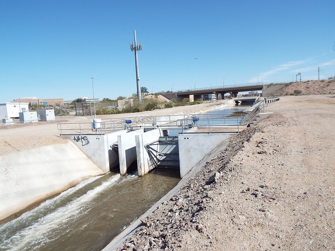
Every canal so far — Swilling’s, the Grand Canal of 1878 — hugged the river bottom on Hohokam alignments. The Arizona Canal Company, incorporated December 20, 1882 by M.W. Kales, Clark Churchill and William Hancock, proposed something new: a canal heading three-quarters of a mile below the Verde confluence and running around the north side of the valley at a higher elevation, opening perhaps 100,000 acres of desert that had never been farmed. The contractor was William J. Murphy, a Union veteran and railroad grader, paid in stock, bonds and land because the company had no cash.
Construction began May 7, 1883 and stopped within two weeks: the head and the first miles lay on the new reservation. Only after the Salt River Indians “in open council” approved a right-of-way agreement — two bridges, stock tanks, and water “when practicable” — did the crews go on. The canal was 36 feet wide on the bottom at the head, carried eight feet of water and 1,000 cubic feet a second, dropped two feet a mile, and crossed Indian Bend Wash on a 1,200-foot flume built on oak piles. At miles 26 and 27 — roughly the future Scottsdale — the crews hit cemented gravel “harder than solid rock” and the banks leaked until they were lined with adobe. The first Arizona Dam, a log-crib weir sunk with one-to-three-ton stones, cost $10,000 and partly washed away in the spring flood of 1885; its replacement, built of 32 carloads of Oregon pine, lasted until the flood of 1891.
In June 1885 Churchill accepted the canal: 42 miles, headgates at every section line, final cost $608,498.24. Murphy missed the inspection tour; he was back East trying to sell bonds. Water rights sold at $500 per 80 acres. Under the canal, Murphy’s brother Samuel filed on 480 acres of Section 27 — downtown Scottsdale — and a Rhode Island banker named Albert G. Utley filed on Section 35, the section he would plat as a townsite in 1894. In 1887 Murphy’s Arizona Improvement Company formed to sell the rest, and on July 4, 1887 the first train steamed into Phoenix. The bench land above the canal was surveyed, watered and for sale. The next customer was an Army chaplain — the story of the 1880s chapter.
Why these four centuries still matter in Scottsdale today
- The eastern border is a treaty line. The Salt River Reservation of June 14, 1879 is why Scottsdale is a long north–south city: it could never grow east.
- The neighbor over the McDowells is a survivor of Skeleton Cave. The Fort McDowell Yavapai Nation, on the Verde beyond Fountain Hills and the county park, descends from the bands the fort was built to fight.
- The canal set the elevation. The Arizona Canal’s contour is the line between Old Town’s flat farm grid and the desert bench; the Arizona Canal Trail rides it today.
- The Preserve keeps the record. Yavapai pottery, Stoneman’s road and the Brown’s Ranch shelter are all inside the city’s own open space, which is the reason the Preserve’s trails avoid certain washes.