
What is the McDowell Sonoran Preserve?
Start with the correction, because it matters: this is not a park.
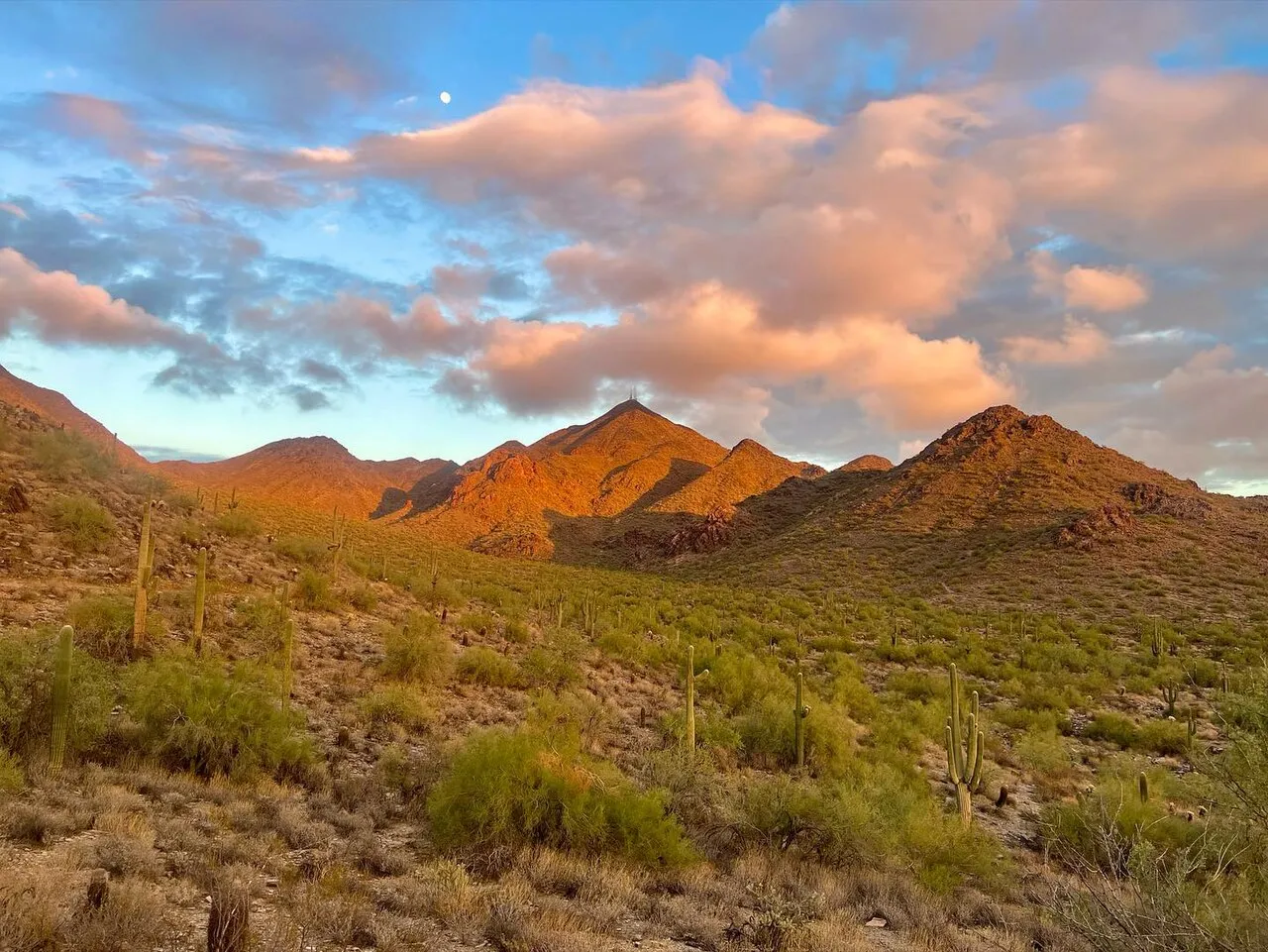
The McDowell Sonoran Preserve is roughly 30,500 acres of Sonoran Desert — the McDowell Mountains and the vast saguaro-studded flats north of them — that the City of Scottsdale bought, piece by piece, specifically so that nothing would ever be built on it. It is the largest urban preserve in the United States, bigger than some national parks, covering a huge slice of the city’s total land area. There are no playgrounds in it, no ramada reservations, no grass. There are trailheads at the edges, more than 230 miles of trail behind them, and desert all the way to the horizon.
Five major trailheads make it usable: Gateway (the flagship, off Thompson Peak Parkway, home of the beloved Gateway Loop), Tom’s Thumb (the dramatic one, climbing to the granite thumb on the ridgeline), Brown’s Ranch (the mellow, bike-happy northern gateway), and Lost Dog Wash and Sunrise serving the southern neighborhoods off Via Linda. Gateway, Tom’s Thumb, Brown’s Ranch and Lost Dog Wash all have restrooms and real parking; all of it is free, sunrise to sunset.
The Preserve is jointly cared for by city staff and the nonprofit McDowell Sonoran Conservancy, whose hundreds of trained volunteer stewards build trail, patrol it, run guided hikes and do actual field science. If someone in a khaki shirt cheerfully asks whether you have enough water — you probably don’t, and that’s a steward.
How to use 30,500 acres
Match the trailhead to the human. First-timers and visitors: Gateway, whose 4.5-ish-mile Gateway Loop is the single best desert sampler in the Valley, with a flat accessible nature path near the trailhead for the non-hikers in your party. Peak-baggers: Tom’s Thumb, a genuinely stout climb to a 140-foot granite monolith with the best views in Scottsdale — start early, it’s steep and exposed. Mountain bikers, trail runners, families, and anyone who just wants miles: Brown’s Ranch, where the northern trails roll gently through cactus forest so dense it looks art-directed. South-siders: Lost Dog Wash, whose namesake trail to the Taliesin Overlook is the after-work standard.
Take the desert seriously. Sunrise to sunset means what it says, and the heat means more. From May through September, be on trail at first light and off by mid-morning; carry a liter of water per person per hour of hiking, which sounds excessive until the first June morning it isn’t. Rattlesnakes are neighbors, not emergencies — give them the trail. Cell coverage is decent near trailheads and spotty in the backcountry.
Share the trail. Everything is multi-use: hikers, bikes and horses. Bikes yield to everyone, everyone yields to horses, and the system works because people actually do it.
Go deeper. The Conservancy runs free guided hikes — geology, wildflowers, full-moon walks — that turn a pretty landscape into a legible one. And if the mountain routes feel like too much, the Preserve pairs beautifully with the tamer, single-trail experience at Pinnacle Peak Park or the neighborhood-scale desert at George “Doc” Cavalliere Park.
The tax people bragged about paying
By the early 1990s, anyone paying attention could run the film forward. Scottsdale’s growth had marched north for three decades — annexation, ranchland, golf, rooftops — and the McDowell Mountains were simply next. Fairways were already climbing the foothills. In 1995, public access to Pinnacle Peak itself was fenced off by surrounding development. The mountains that formed the city’s entire eastern skyline were, parcel by parcel, becoming someone’s backyard.
What happened next is the civic legend Scottsdale has most earned the right to retell. Citizens — hikers, scientists, retirees, the volunteer land trust that would become the McDowell Sonoran Conservancy — organized not around stopping growth, but around buying the mountains. On May 23, 1995, Scottsdale voters approved a dedicated 0.2% sales tax for preserve land acquisition, by a margin near two-to-one. Cities pass taxes for stadiums and freeways; Scottsdale passed one for desert, and then in 2004 did it again, adding another 0.15% to expand the vision far beyond the mountains into the northern desert toward the Tonto National Forest.
The result, assembled over three decades of patient acquisition, is the preserve as it stands: about 30,500 acres held as natural open space in perpetuity — protected land, not park inventory — with the Conservancy’s volunteer stewards putting in thousands of hours a year building trail, restoring damaged desert and teaching visitors what they’re walking through.
Why “preserve,” not “park,” is the whole point
The vocabulary is doing real work. A park is land a city improves: it grades, irrigates, programs and — when priorities shift — repurposes. Parkland gets nibbled by rec centers, parking lots and good intentions. A preserve inverts the deal: the land’s job is to stay exactly as it is, and the humans are guests at the edges. That’s why the Preserve’s amenities stop at the trailhead, why the trails are engineered to shed water and resist shortcutting, and why the protection runs deeper than ordinary zoning — this land was bought by direct public vote for one stated purpose, forever.
It’s the same insight that built the Indian Bend Wash Greenbelt a generation earlier, scaled from a floodway to a mountain range: the smartest thing a desert city can do with its most important land is not build on it — and say so in writing. The Greenbelt saved south Scottsdale from a concrete channel; the Preserve saved the skyline itself. Between them, they’re the reason this city, of all the Valley’s cities, still feels like it’s in the Sonoran Desert rather than merely on top of it. Sunrise at Brown’s Ranch, forty minutes from the airport, will make the case better than any ballot summary ever did.